
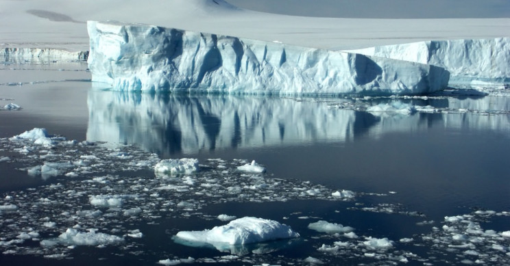
The melting of Thwaites Glacier already accounts for 4% of global sea-level rise.
Source: Interesting Engineering
A team of international scientists were able to drill deep into the Thwaites Glacier for the first time ever, aiming to better understand the impact climate change is having on the Antarctica region.
For two months the international team of researchers were stationed in Antarctica, gathering data using ocean instruments and cored sediment on the Thwaites Glacier, which is among the most important glaciers in Antarctica.
Hot water drill gets researchers to the grounding line
Thwaites Glacier is about the size of Florida and is susceptible to the warmer oceans. The melting of Thwaites already accounts for 4% of the global rise in sea level. The amount of ice melting off has close to doubled over the last 30 years. It’s among the fastest-changing regions of Antarctica.
MELT is the International Thwaites Glacier Collaboration’s ice-based project to get a better understanding of how the warmer waters are impacting the glacier at the grounding line. That’s the point where the glacier becomes an ice shelf.
By drilling deep into the glacier, it allows researches to accurately predict the potential sea-level contribution of the glacier. To gather all the necessary data the MELT team, which included scientists from Georgia Tech, developed Icefin, an underwater robot to navigate the waters underneath the glacier and to collect data in the area where the glacier meets the sea.
Data can help researchers understand climate change’s impact
Using a hot-water drill, the MELT team was able to drill nearly half a mile or through 2,300 feet of ice to get to the ocean and seafloor. The Icefin was then able to swim more than a mile to the Thwaites grounding zone to gather data including measurements and images. The robot also mapped the glacier’s melting.
“We designed Icefin to be able to finally enable access to grounding zones of glaciers, places where observations have been nearly impossible, but where rapid change is taking place,” said Dr. Britney Schmidt, lead scientist for Icefin and associate professor in Georgia Tech’s School of Earth and Atmospheric Sciences Schmidt, a co-investigator on the MELT project, in a press release announcing the results. “We’re proud of Icefin since it represents a new way of looking at glaciers and ice shelves. For really the first time, we can drive miles under the ice to measure and map processes we can’t otherwise reach. We’ve taken the first close-up look at a grounding zone. It’s our ‘walking on the moon’ moment.”
Source: Interesting Engineering


Leave a Comment
You must be logged in to post a comment.